Quick answer: The best cupar walks join Cupar, Ceres and Hill of Tarvit. The Ramblers’ Moor Road circular is the full-day loop at 12.9 km, graded Moderate.
Shorter outings and a different mix of terrain are covered below. For the rest of the county, see the guide to walking routes in Fife.
Choosing a route around Cupar
The ground north of Cupar is the reason to walk here. Fife Walking describes these hills as a compact group of wee hills making up the high ground north of Cupar, so a good day out does not need a long drive or a big mountain. Welcome to Fife also lists Cupar for its history and nature walks.
Four questions settle most choices:
- How much time do you have? The Moor Road circular is a long day. A shorter route from Cupar towards Tarvit suits a half-day.
- Do you want a village-to-village circuit? Only the longer loop passes through Ceres before it climbs to Hill of Tarvit and returns to Cupar.
- How much climbing is acceptable? The ascent figures below show how the routes compare.
- What are you wearing on your feet? Route notes recommend walking boots over trainers for most Fife routes.
| Route | Distance | Climb and grade | Planning use |
|---|---|---|---|
| Moor Road circular: Cupar, Ceres, Hill of Tarvit, back to Cupar | 12.9 km / 8.0 mi | Ascent 105 m / 344 ft; Moderate; good paths | Best for a full day and for walkers who want the village-to-village circuit. |
| Cupar to Tarvit via Moor Road (Plotaroute) | 3.438 miles | Starts near Cupar; boots recommended over trainers for most routes | A shorter option when the full circular is too much. |
Distances and grades come from the Ramblers Moor Road listing and the Plotaroute Tarvit route.
Choose the circular if you are comfortable with a Moderate grade and a full day. Choose the shorter route if you are testing your fitness, walking with less daylight, or want to see Tarvit without committing to the whole loop.
The Moor Road circular from Cupar
The Ramblers describe the walk as going along the Moor Road path to Ceres, then on to Hill of Tarvit and back to Cupar. It is graded Moderate, covers 12.9 km (8.0 mi) and has 105 m (344 ft) of ascent, all on good paths.
Why the circuit works
The loop gives you a village stop and a hill on the same day. Ceres sits on the route between the Moor Road path and Hill of Tarvit, so it breaks the walk naturally. Because the route is a loop, you can join it at Ceres or at Cupar, but the listed start is in Cupar, so build the day around that point.
Timing the day
The Ramblers listed a group departure on Saturday 23 May 2026 with a 10:00 am start and an estimated finish of 2:30 pm. Treat that as a guide to the pace of a led group on that date. Your own time will depend on your pace, stops and the weather.
Hill of Tarvit and Tarvit Hill
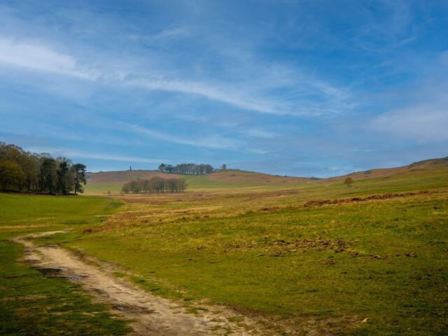
Hill of Tarvit, also written Tarvit Hill, stands 211 m high, and Fife Walking lists a selection of routes up it. That makes it the natural objective for walks near Cupar, and the highest point of the Moor Road circular.
The shorter Plotaroute route runs from near Cupar via Moor Road for 3.438 miles. If you want the summit without the village circuit, this is the more practical choice. If you want a gentler day, check the climb on the map before you commit to a Tarvit route.
Parking and start points
For the Moor Road circular, the Ramblers advise parking off Ceres Road in Cupar, outside the cemetery. This is the start point to plan around if you are driving yourself.
The group walk used a different meeting point: the car park behind the West Port hotel, with a meeting time of 8:45 am. That arrangement belongs to the group, so a self-guided walker should not assume the same space is available to them.
Anyone wanting a Ceres start should note that the supplied route details give Cupar as the start, and the circuit reaches Ceres on the way to Hill of Tarvit. Use the Cupar start unless you have checked a local source for parking in the village.
Easy walks and beginner choices
The Moor Road circular is graded Moderate, not easy, but its paths are described as good. A beginner who walks regularly can manage it with a full day in hand. Someone newer to walking should start with the shorter Cupar to Tarvit route instead.
- Footwear: route notes recommend walking boots over trainers for most Fife routes, and mention unsurfaced or rough paths.
- Access: walkers are responsible for acting in accordance with the Scottish Outdoor Access Code, as the Plotaroute notes remind users.
- Navigation: carry a map even on a listed route. The fife walking map guide explains what to look for.
Troubleshooting your plan
- The full loop looks too long: switch to the shorter Tarvit route from near Cupar, which is 3.438 miles.
- You only have trainers: pick the shorter route and stay on the clearest paths, or wait until you have boots.
- You want to join a group: the Ramblers listing gives a date, meeting time and finish estimate, so check the current listing instead of relying on a past date.
- You prefer the coast: the fife coastal path sections guide covers the shoreline walking.
Frequently asked questions
How long is the Hill of Tarvit walk?
It depends on the route. The Ramblers’ Moor Road circular covers 12.9 km (8.0 mi) via Ceres, while a Plotaroute route from near Cupar via Moor Road lists 3.438 miles.
How high is Hill of Tarvit?
Fife Walking gives its height as 211 m and lists a selection of routes up the hill.
Do I need walking boots for walks near Cupar?
Plotaroute’s route notes advise sturdy boots rather than trainers on most routes, as some sections are unsurfaced or rough underfoot.
What access rules apply on these paths?
Walkers are responsible for acting in accordance with the Scottish Outdoor Access Code.